
U.S. News
Notice new markers on Plano trails? They’re designed to boost safety
By 
Editor
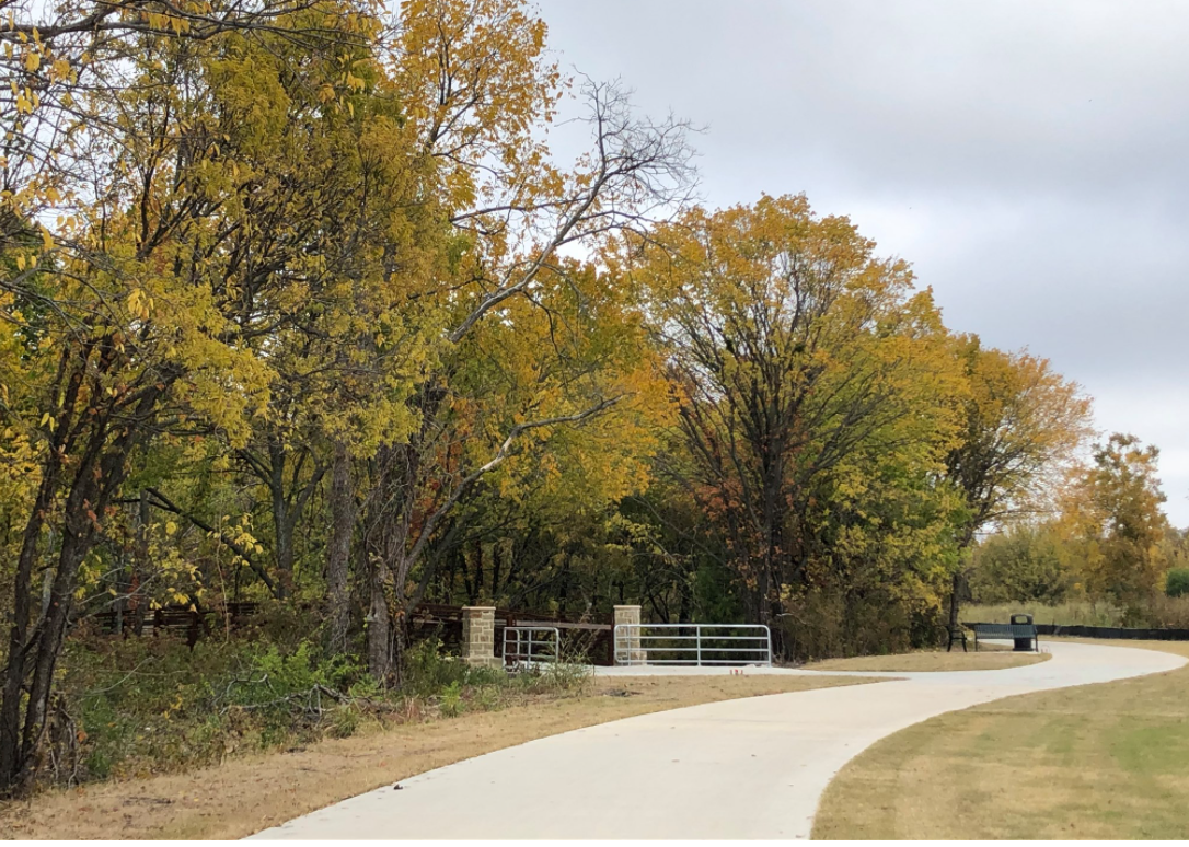
PLANO, TX – Plano is installing signs designed to boost safety and emergency access on city trails.
The system allows first responders to pinpoint the exact location of any emergency. It will also let emergency crews know the best way to get to the location.
Arlington Police Department held a press event on the 25th anniversary of Amber Hagerman’s death…
A pilot program to test the system’s effectiveness was implemented along Chisholm Trail in 2019. The system is now being expanded to other Plano trails, according to a city document.
Here’s how it works: Signs will be posted alongside a trail about every one-third of a mile to ensure that trail users are always near an emergency marker.
Each sign will have a unique location identifier. The ID listed on each trail marker provides emergency response teams with the trail section, trail name, and orientation.
If you need emergency assistance while on a trail, find the nearest emergency trail marker, dial 911, and tell the operator the unique location ID listed on the sign. After gathering information, and possibly asking you to stay on the line, first responders will be dispatched.


Investigators are seeking the identity of the suspect involved in the homicide on Elm Street
Dallas, TX – According to the Dallas Police Department, the shooting occurred around 3:09 a.m. early Sunday morning. It happened in...

The Department of State Health Services is seeking grant applications for the DSHS Federally Qualified Health Center Incubator Program
Plano, TX – According to the state officials, the program grants will help eligible non-profit and public health care providers...

DPS reminds drivers to use extra caution in and around school zones and neighborhoods
Plano, TEXAS – State officials said that this includes knowing the Texas laws about driving near stopped school buses and...


Governor Greg Abbott sent a letter to President Joe Biden in response to a potential “discretionary redesignation” of the Permian Basin by the Environmental Protection Agency
Plano, TX – According to the state officials, the letter reiterates how the EPA is employing flawed logic and data...